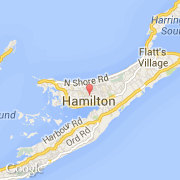
Paroisse Devonshire

bermudes

La paroisse Devonshire posséde 121 villes.

La paroisse Devonshire s'étend sur 6 707 km² et compte 1 109 900 habitants pour une densité de 165,48 habitants par km².
Le nom français de la paroisse est Devon.

Villes de Devonshire

A

  • Aeolia Drive
  • Alexandra Road

B

  • Barkers Hill
  • Bell Lane
  • Belmer Drive
  • Belvedere Road
  • Bleak Farm Close
  • Border Lane East
  • Border Lane North
  • Border Lane West
  • Brackish Pond Lane
  • Brighton Hill Road
  • Brighton Lane
  • Brimstone Hill
  • Burnt House Hill
  • Bushy Lane

C

  • Camden North Road
  • Cavendish Close
  • Cedar Park Road
  • Cedar Vale Lane
  • CedarBridge Lane
  • Chaingate Hill
  • Christ Church Lane
  • Christopher's Close
  • Cloverdale Lane
  • College Hill Road
  • Crown Hill Lane

D

  • Derwent Lane
  • Derwent Lane South
  • Devon Heights Close
  • Devon Heights Road
  • Devon Lane
  • Devon Spring Lane
  • Devon Spring Road
  • Devondale Drive
  • Devonshire Bay Road
  • Dock Hill

F

  • Foothills Road
  • Fort Hill Road
  • Friswells Lane
  • Frog Lane

G

  • Gables Lane
  • Garthowen Road
  • Glebe Lane
  • Green Acres Road
  • Greenwich Lane
  • Gymnasium Road

H

  • Happy Valley Road
  • Headquarters Hill
  • Hesitation Lane
  • High Point Lane

J

  • Jackson Drive
  • Jubilee Road
  • Junction Lane

K

  • Kent Avenue
  • Kent Lane

L

  • Lamas Close
  • Lamas Drive
  • Leafy Way
  • Leeson Lane
  • Locust Lane
  • Long Range Hill
  • Long Ridge Pass
  • Lookout Lane
  • Loyal Hill Crescent
  • Loyal Hill Pass
  • Loyal Hill Road

M

  • Mingston Lane
  • Montpelier Road
  • Morning Glory Drive

N

  • North Ridge Close
  • North Shore Road
  • Northcliff Lane

O

  • Ocean Avenue
  • Old Military Road
  • Oleander Lane
  • Oleander Square
  • Orange Valley Road
  • Orchard Grove
  • Orchard Lane

P

  • Palmetto Road
  • Pampas Lane
  • Park View Lane
  • Parsons Lane
  • Pereira's Drive
  • Poinciana Crescent
  • Poinciana Road
  • Prospect Road

R

  • Rec-View Hill
  • Roberts Alley
  • Roberts Avenue
  • Rocky Bay Lane

S

  • Schools Drive
  • Secret Lane
  • South Road
  • Spur Lane
  • Store Lane

T

  • Tea Rose Lane
  • Tee Street
  • The Glebe Road
  • Third Avenue
  • Town House Drive
  • Tree Lane
  • Tribe Lane
  • Tribe Road #1
  • Tribe Road #2
  • Tribe Road #3
  • Tribe Road #3B
  • Turk's Head Lane

U

  • Up and Down Lane
  • Upland Close
  • Upland Lane
  • Upland Street

V

  • Valley Heights Road
  • Vesey Street
  • Vicker's Bay Road

W

  • Watlington Lane
  • Watlington Lane North
  • Watlington Road East
  • Watlington Road West
  • Woodside Drive