Ville de Melton Brand (England)

royaume-uni

Informations

Chiffres

Code pays :
GB
Code postal :
DN5
Latitude :
53.52113
Longitude :
-1.21868
Zone horaire :
Europe/London
Fuseau horaire :
UTC
Heure d'été :
Y

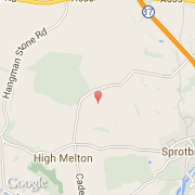
La ville de Melton Brand appartient à la nation England, au comté South Yorkshire et au district Doncaster.

Villes voisines

  • Marr ~2 km
  • Cadeby ~3 km
  • High Melton ~2 km
  • Sprotbrough ~2 km
  • Levitt Hagg ~3 km
  • Pickburn ~4 km
  • Conisbrough ~5 km
  • Scawsby ~3 km
  • Warmsworth ~4 km

Les transports de Melton Brand

Aéroport international
Leeds Bradford ~48 km
Autres transports
Sheffield City ~18 km
Church Fenton ~35 km
Leeds Railway Station ~37 km
Booking.com

Rejoignez-nous !

Vous aimez ? Partagez !