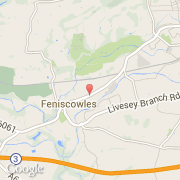
Ville de Cherry Tree (England)

royaume-uni

Informations

Chiffres

Code pays :
GB
Code postal :
BB2
Latitude :
53.72833
Longitude :
-2.53045
Zone horaire :
Europe/London
Fuseau horaire :
UTC
Heure d'été :
Y

La ville de Cherry Tree appartient à la nation England, au comté Lancashire et au district Blackburn with Darwen.

Villes voisines

  • Feniscowles ~1 km
  • Pleasington ~1 km
  • Livesey ~2 km
  • Blackburn ~2 km
  • Tockholes ~3 km
  • Abbey Village ~3 km
  • Withnell ~4 km
  • Riley Green ~3 km
  • Mellor Brook ~5 km

Les transports de Cherry Tree

Aéroports internationaux
Manchester ~45 km
Liverpool ~49 km
Autres transports
Warton ~23 km
Manchester Picadilly Station ~34 km
Liverpool Railway Station ~47 km
Booking.com

Rejoignez-nous !

Vous aimez ? Partagez !