Ville de Bury St Edmunds (England)

royaume-uni

Informations

Chiffres

Code pays :
GB
Code postal :
IP29
Latitude :
52.19017
Longitude :
0.65818
Zone horaire :
Europe/London
Fuseau horaire :
UTC
Heure d'été :
Y

La ville de Bury St Edmunds appartient à la nation England, au comté Suffolk et au district St Edmundsbury.

La ville de Bury St Edmunds compte 35 015 habitants (recensement de 2001).
(Abolish Bury Town Council) pour le mandat mai 2007-?.
Le nom français de la ville est Bury St Edmunds.
Le site Internet de Bury St Edmunds est http://www.stedmundsbury.gov.uk
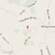
Villes voisines

  • Whepstead ~1 km
  • Rede ~2 km
  • Ickworth ~3 km
  • Brockley ~3 km
  • Horringer ~4 km
  • Chedburgh ~3 km
  • Chevington ~3 km
  • Somerton ~5 km
  • Hartest ~6 km

Les transports de Bury St Edmunds

Aéroport international
Stansted ~45 km
Autres transports
Honington ~19 km
RNAS WATTON ~19 km
Lakenheath ~25 km
Mildenhall ~22 km
Wattisham ~22 km
Booking.com

Rejoignez-nous !

Vous aimez ? Partagez !