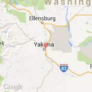
Ville de Union Gap (Washington)

etats-unis

Informations

Chiffres

Code pays :
US
Code postal :
98901
Latitude :
46.60792
Longitude :
-120.46759
Zone horaire :
America/Los_Angeles
Fuseau horaire :
UTC-8
Heure d'été :
Y

La ville de Union Gap appartient à l'état Washington et au comté Yakima.

La ville de Union Gap s'étend sur 13,11 km².
La devise de Union Gap est "The old town with new ideas". Le site Internet de Union Gap est http://www.census.gov

Villes voisines

Les transports de Union Gap

Aéroport international
Yakima Air Terminal McAllister Field ~7 km
Booking.com

Rejoignez-nous !

Vous aimez ? Partagez !