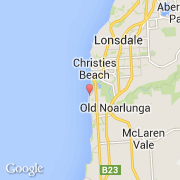
Ville de Port Noarlunga South (South Australia)

australie

Informations

Chiffres

Code pays :
AU
Code postal :
5167
Latitude :
-35.16977
Longitude :
138.46693
Zone horaire :
Australia/Adelaide
Fuseau horaire :
UTC+9:30
Heure d'été :
Y

La ville de Port Noarlunga South appartient à l'état South Australia et à la région SA City Subs.

Villes voisines

  • Port Noarlunga ~2 km
  • Seaford Meadows ~2 km
  • Seaford ~3 km
  • Moana ~3 km
  • Christies Beach ~3 km
  • Noarlunga ~3 km
  • Old Noarlunga ~3 km
  • Seaford Rise ~4 km
  • Seaford Heights ~4 km

Les transports de Port Noarlunga South

Aéroport international
Adelaide Intl ~26 km
Autre transport
Adelaide Parafield ~45 km
Booking.com

Rejoignez-nous !

Vous aimez ? Partagez !