Ville de Inglewood (Western Australia)

australie

Informations

Chiffres

Code pays :
AU
Code postal :
6052
Latitude :
-31.92176
Longitude :
115.88552
Zone horaire :
Australia/Perth
Fuseau horaire :
UTC+8
Heure d'été :
Y

La ville de Inglewood appartient à l'état Western Australia et à la région Stirling.

La ville de Inglewood s'étend sur 2,9 km² et compte 5 503 habitants (recensement de 2010) pour une densité de 1 897,59 habitants par km². L'altitude moyenne est de 40 m.
Le maire est Vacante.
Le nom anglais de la ville est State Suburbs Inglewood, le nom espagnol est Inglewood.
Le site Internet de Inglewood est http://www.cityofinglewood.org
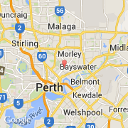
Villes voisines

Les transports de Inglewood

Aéroport international
Perth Intl ~8 km
Autres transports
Burswood Park Helipad ~4 km
Perth Jandakot ~20 km
RAAF Pearce ~31 km
Rottnest Island ~34 km
Booking.com

Rejoignez-nous !

Vous aimez ? Partagez !